
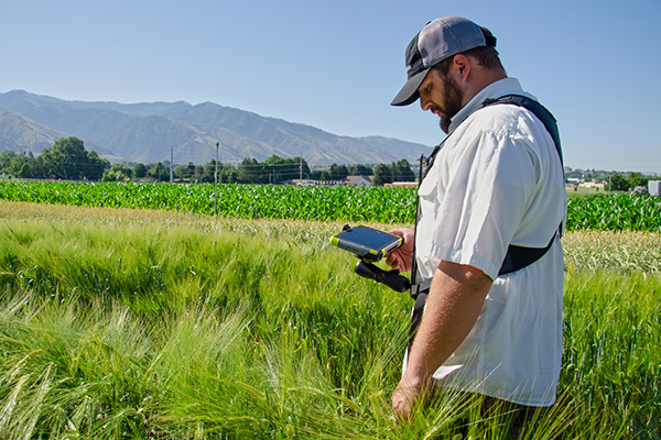
In the world of agriculture, precision is paramount. Every square foot of useable land should be optimized for the best possible yield. Whether growers focus on production, soil sampling, crop scouting, pivot irrigation, or one of the many other techniques used to improve yield, they need accurate and reliable equipment. Modern agriculture demands efficiency, precision, and data-driven solutions. With the need for reliable information, data collection software plays a pivotal role in shaping the future of farming. Juniper Systems offers growers a total solution that makes incorporating data collection into your farming practices easy.
Using Juniper Systems rugged tablets paired with a GPS receiver and data collection software makes collecting and mapping data an easy and cost-efficient experience. Each piece of this solution was designed to provide professionals around the world with the ultimate mapping and data collection experience in any environment. In this article, we will discuss how these tools can transform your farm.
UINTA
Unita Mapping and Data Collection Software equips growers with the tools they need to make informed decisions regarding fertilization, irrigation, and crop selection. With the help of GPS technology, sensors, and data analytics, growers can create detailed, data-driven maps of their fields. These maps can highlight variations in soil properties, moisture levels, and crop health.
Uinta software offers growers an efficient data collection experience. Uinta eliminates the need to record and store data on paper where it can go missing or get damaged and instead stores it in a central location that is easy to access and export as needed. Users can also create customized templates to make data entry easier and fitted to their needs.
In addition to data collection, Uinta is also used for mapping in many industries. Asset management, field mapping, and property boundary mapping can all be accomplished using Uinta.
To learn more about Uinta, check out the Juniper Systems website.
GEODE
Useful maps can’t be created without accurate geo-referenced data. The Geode GNSS Receiver provides users with accuracies ranging from sub-meter to centimeter with RTK corrections, depending on how precise they need to be. Pairing Uinta with the Geode means that growers can create reliable maps and attach a GPS location to the data they collect.
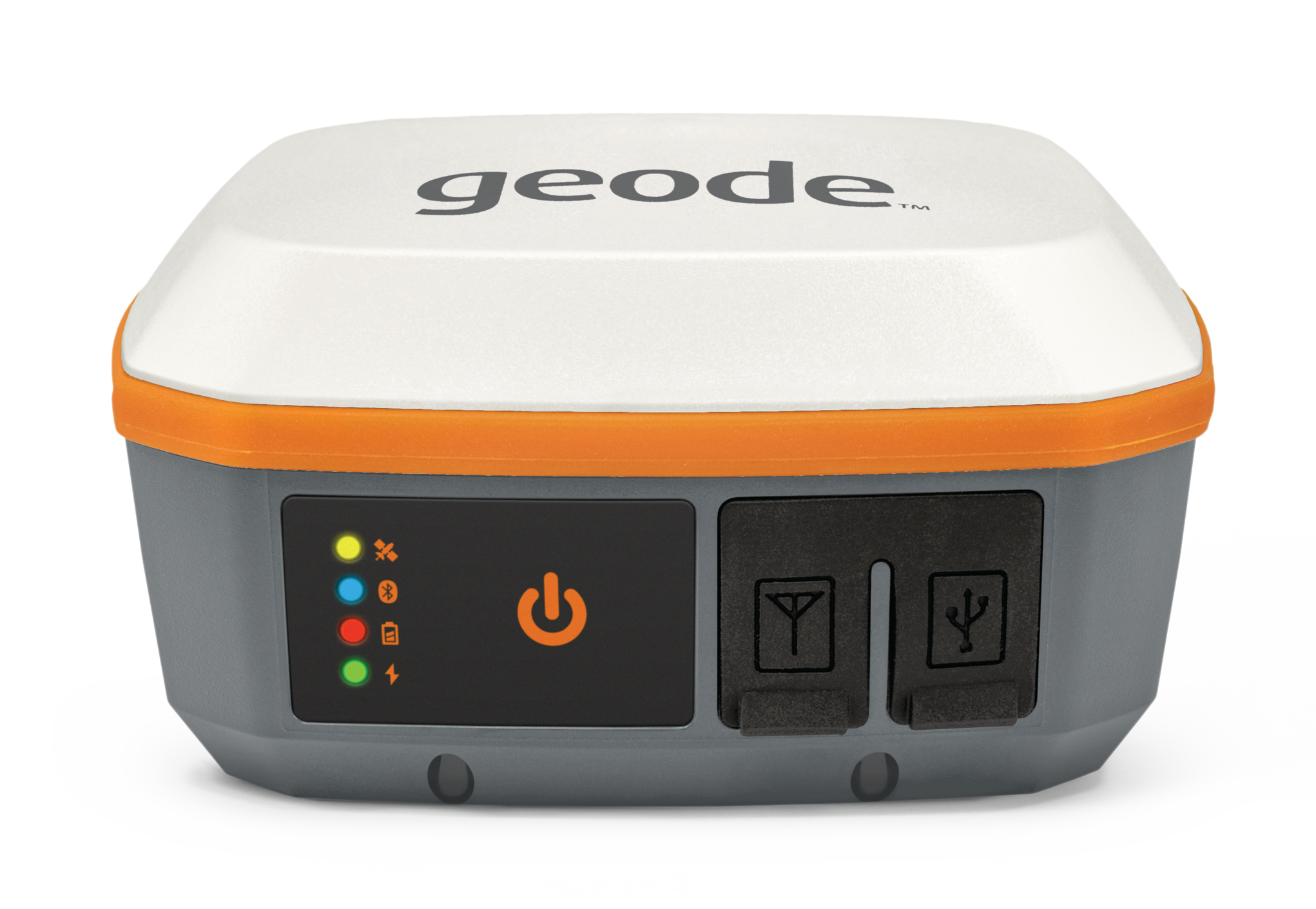
The Geode is an instrumental tool for users who are trying to better understand crop performance by tracking diseased and low-yield areas. Utilizing GPS makes it easier to navigate to specific areas in the field each year to record patterns and developments at specific locations throughout the years.
For a more comprehensive look at the Geode, visit Juniper Systems product page.
RUGGED HANDHELD
While Unita and Geode are both compatible with other devices, Juniper Systems total solution provides users with durable, high-quality handhelds equipped to handle any working conditions. The Mesa is specifically designed to operate in outdoor environments and harsh conditions.
A reliable mobile handheld can make a huge impact during the workday. Equipped with a sunlight-readable display and an all-day battery life, Mesa 4 users can focus on collecting data without interruptions.
Like other Juniper Systems products, the Mesa 3 and Mesa 4 are customizable. If users need options like scanners, cell modem, or other hardware, Juniper Systems has it.
CONTACT JUNIPER SYSTEMS TODAY
Data has transformed the way growers approach practices like soil sampling and field mapping. Utilizing precision ag equipment ensures growers get reliable, real-time data, historical insights, and predictive analytics. Growers and agronomists can make more informed and efficient decisions, ultimately leading to improved yields and more efficient farming practices.
Contact us today to learn more about how data collection can improve your business.